

Inside: Modern weather instruments and their uses are more sophisticated than ever. Show your students how weather is forecasted with this lesson.
Need to check the weather? Simple! Just check your phone or turn on the news. Chances are high your local meteorologist has you covered with up to the minute data. But how exactly do they DO that? With pretty sophisticated weather instruments, that’s how. Let’s learn how to teach about these weather instruments in Science class.
When teaching weather tools, it is helpful to start out by actually watching meteorologists forecast the weather. Make sure to pause often, explaining the steps the meteorologist is using to decipher the weather. This may mean explaining about changing air pressure, fronts, and more. I am fortunate to have a large TV in my classroom. Teachers can also use the internet to show a weather forecast. If neither of these options are available, show the forecast from your local newspaper.
Then, we discuss meteorologists and how they do their jobs. They use several sources of information, then blend them together to create the forecast. Let’s take a look at one type of weather instrument meteorologists commonly use., Doppler Radar.
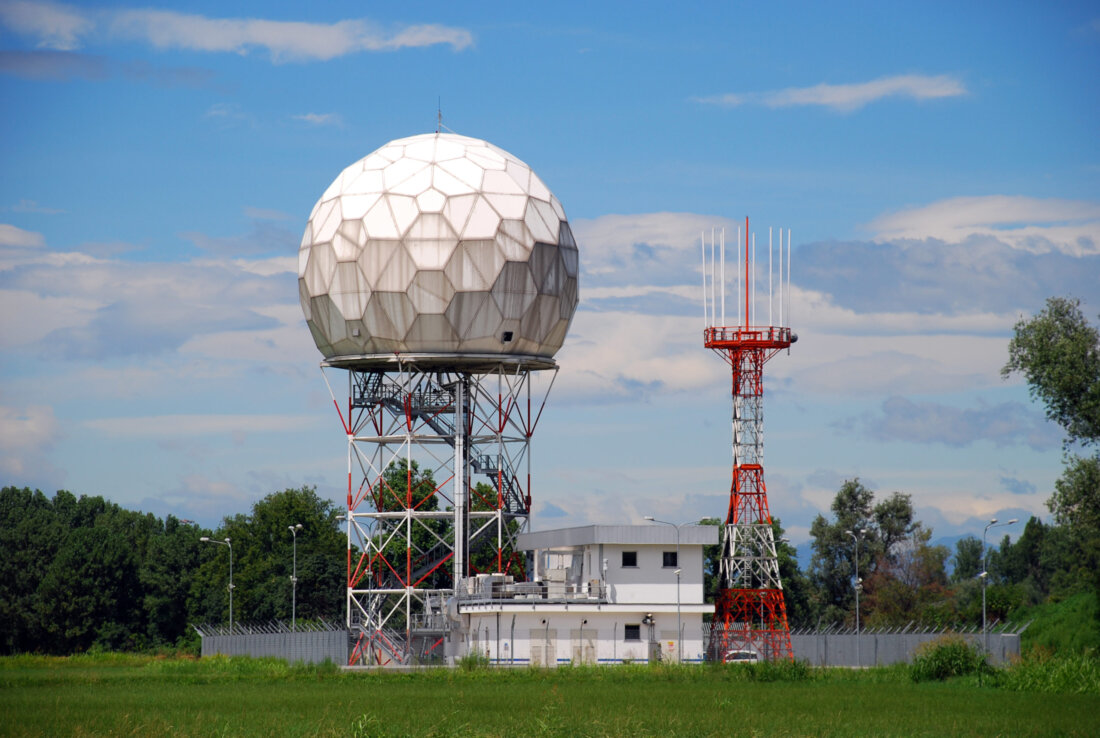
Doppler radar is a beam of energy in the form of a radio wave that is sent out into the atmosphere. It bounces off objects in the atmosphere, telling scientists what is happening. This type of weather tool may be difficult for kids to imagine. Make sure to show them a picture of it in order for them to better understand the size. For a color picture, check this resource out here. There are also several great YouTube videos that show the inside of a Doppler Radar building. One of my favorite videos is this one. Students can really get an idea of the size of the radar.
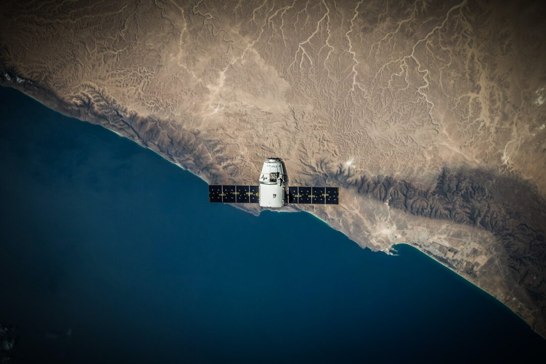
I usually like to ask students what services satellites provide for us. They are sure to know that TV and radio satellites are up there, but how about our weather satellites? Students may be interested in learning there are many different types of satellites high up in Earth’s atmosphere.
There are two different types of weather satellites: ones that stay in the same spot over Earth, and others that orbit the Earth several times per day. Currently, NOAA operates 8 satellites to monitor the weather. Let’s break this down.
Geostationary Operational Environmental Satellite (GOES). When introducing these satellites, I like to say the name to my students, then explain what geostationary means. Simply put, these satellites are placed 22,000 miles above Earth’s surface, and programed to a speed that exactly matches Earth’s rotation. This way, the satellite can stay fixed in one spot over the Earth. This type of satellite is typically used to give us our nightly weather we see on the news. This simple video produced by NOAA shows students the two GOES satellites that watch over the United States.
A different type of satellites is called the Polar Operational Environmental Satellite. These machines are much different than GOES satellites. POES satellites are much lower in altitude. They fly at just over 520 miles in altitude. Because of this, they have to move much faster in order to overcome the force of Earth’s gravitational pull. POES satellites – zipping around Earth so quickly, cannot stay in the same spot. Instead, they capture pictures while traveling around Earth from the north pole to the south pole around 14 times per day! POES satellites are useful for tracking severe weather such as hurricanes. The low altitude of the satellite can capture extremely clear pictures of weather phenomena.
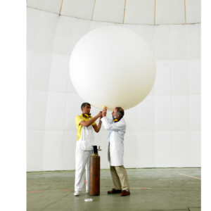
Back on Earth, Meteorologists use weather balloons to capture information in the lower parts of the atmosphere. These giant balloons are filled with either helium or hydrogen. Weather balloons are typically inflated to a diameter of about 6 ft. As they rise into the atmosphere, the balloon will eventually expand to over 20 feet in diameter! This is due to the decreasing amount of air pressure on the balloon. Eventually, the balloon will pop after around 90 minutes and at an altitude of about 100,000 feet.
A radiosonde attached to the balloon gathers data during this trip. Its job is to collect information on air pressure, temperature and humidity in the troposphere and lower stratosphere.
So how do Meteorologists find the radiosonde? Well, sometimes they don’t. In fact, despite the radiosonde containing a mailing envelope and directions for return, only about 20% are ever recovered. If they do make it back, they are fixed and used again in the future. Supplement your lesson: show your students this video about weather balloons. If you would like a reading source, consider this Weather Tools reading activity.
The above mentioned weather tools are pretty sophisticated, but your classroom can still have an inexpensive and worthwhile weather station! It doesn’t take much money to start kids out right on the path to weather forecasting.
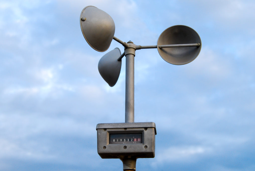
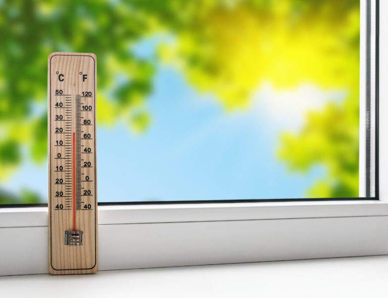
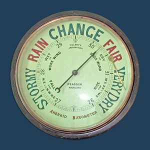
To get started, all you really need is a thermometer, barometer, rain gauge, wind vane or wind sock and anemometer. I included some links of inexpensive resources I found. I am in no way affiliated with them. You can also build your own rain gauge, just watch this video that uses a 2 liter bottle.
The resource below is what I use to teach about weather tools. Additionally at this time, I introduce the weather tools located in my classroom and outside the window- the students will now be in charge of this part of class. Finally, I use the the listed YouTube videos to supplement what I cannot physically show them.
| Cookie | Duration | Description |
|---|---|---|
| cookielawinfo-checkbox-analytics | 11 months | This cookie is set by GDPR Cookie Consent plugin. The cookie is used to store the user consent for the cookies in the category "Analytics". |
| cookielawinfo-checkbox-functional | 11 months | The cookie is set by GDPR cookie consent to record the user consent for the cookies in the category "Functional". |
| cookielawinfo-checkbox-necessary | 11 months | This cookie is set by GDPR Cookie Consent plugin. The cookies is used to store the user consent for the cookies in the category "Necessary". |
| cookielawinfo-checkbox-others | 11 months | This cookie is set by GDPR Cookie Consent plugin. The cookie is used to store the user consent for the cookies in the category "Other. |
| cookielawinfo-checkbox-performance | 11 months | This cookie is set by GDPR Cookie Consent plugin. The cookie is used to store the user consent for the cookies in the category "Performance". |
| viewed_cookie_policy | 11 months | The cookie is set by the GDPR Cookie Consent plugin and is used to store whether or not user has consented to the use of cookies. It does not store any personal data. |
One Response